Plota now has the largest free database of licensed HMOs. Its licence data comes from councils accounting for 95% of HMO licences in the latest available official statistics,* and you can search them by postcode, town or council at plota.co.uk/hmo-licences.
A house in multiple occupation is a home shared by 3 or more people who are not one household. Councils must license the larger ones, and many license smaller HMOs under schemes of their own. Searching is free and needs no account.
Residents can check whether a house on their street is licensed, and for how many people. Agents and investors can see how many HMOs a road already holds before they buy or apply for planning.
What a licence record holds
The licences come from each council's public HMO register. Where the council publishes them, a record gives the licence type (mandatory, or additional where a council runs its own scheme for smaller HMOs), the most people and households it allows, its bedrooms and storeys, and when it started and expires. Some councils record details from the licence application, which may differ from the final licence.
A licence from Portsmouth has the same fields as one from Glasgow, left empty where a register does not give one. Occupancy and rooms are numbers, and each date says whether the register gave the day, the month or only the year.
Councils do not always update a register when a licence lapses, so a licence past its expiry date is shown as expired whatever the register says. Each card also lists the planning applications at the address and marks any to create or extend an HMO.
The map
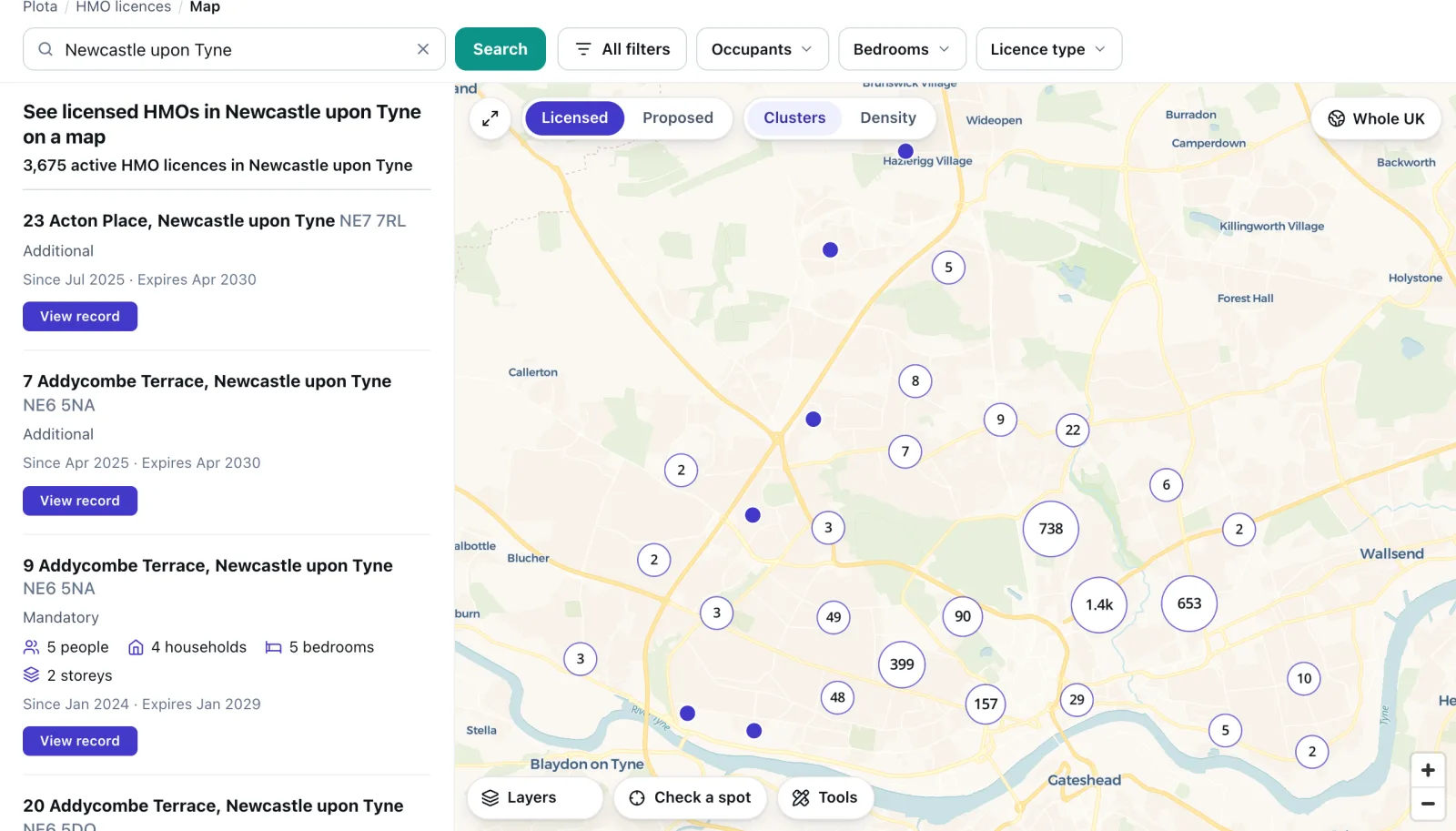
The map groups licences into clusters, each with its count, and splits them into single houses as you zoom in. Click one and its card opens with everything the register gives for it. The list beside the map holds the same licences, nearest first when you search a place.
The map shows active licences unless you ask for others: licensed or applied for, and not past their expiry date. Expired and revoked licences appear when you choose them in Filters.
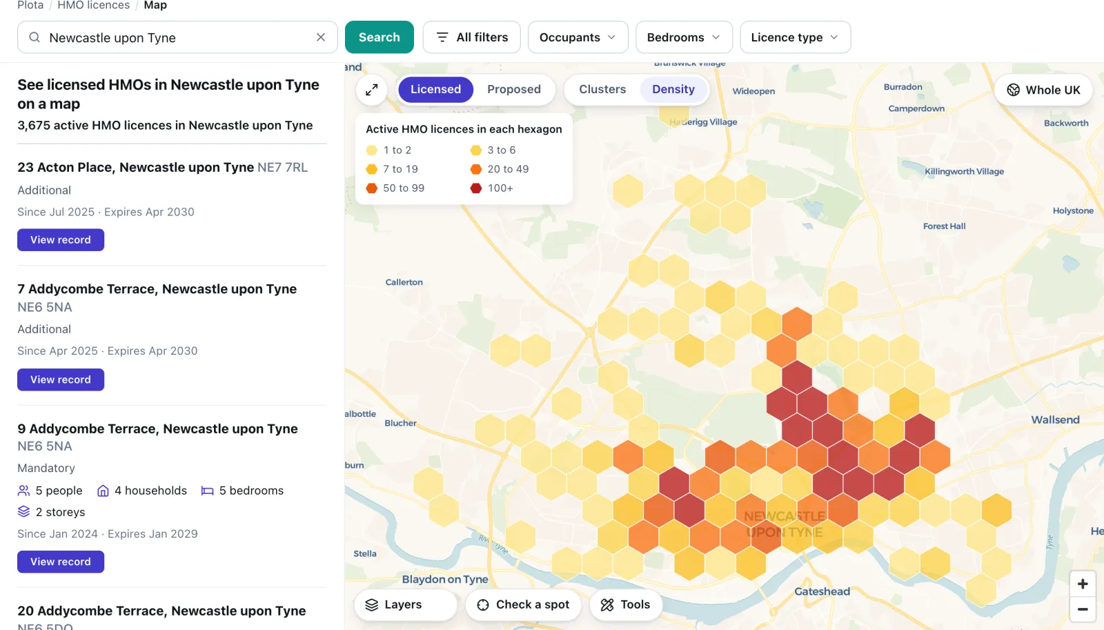
Density swaps the clusters for hexagons shaded by the number of active licences in each, from 1 or 2 up to 100 or more. It shows which neighbourhoods of a city hold most of its HMOs.
Filters narrow the map by occupants, bedrooms and licence type. The Expiring filter finds licences that end within the next 3, 6, 12 or 24 months, and needs a free sign-in. Everything else on the map is free without one.
HMO planning proposals
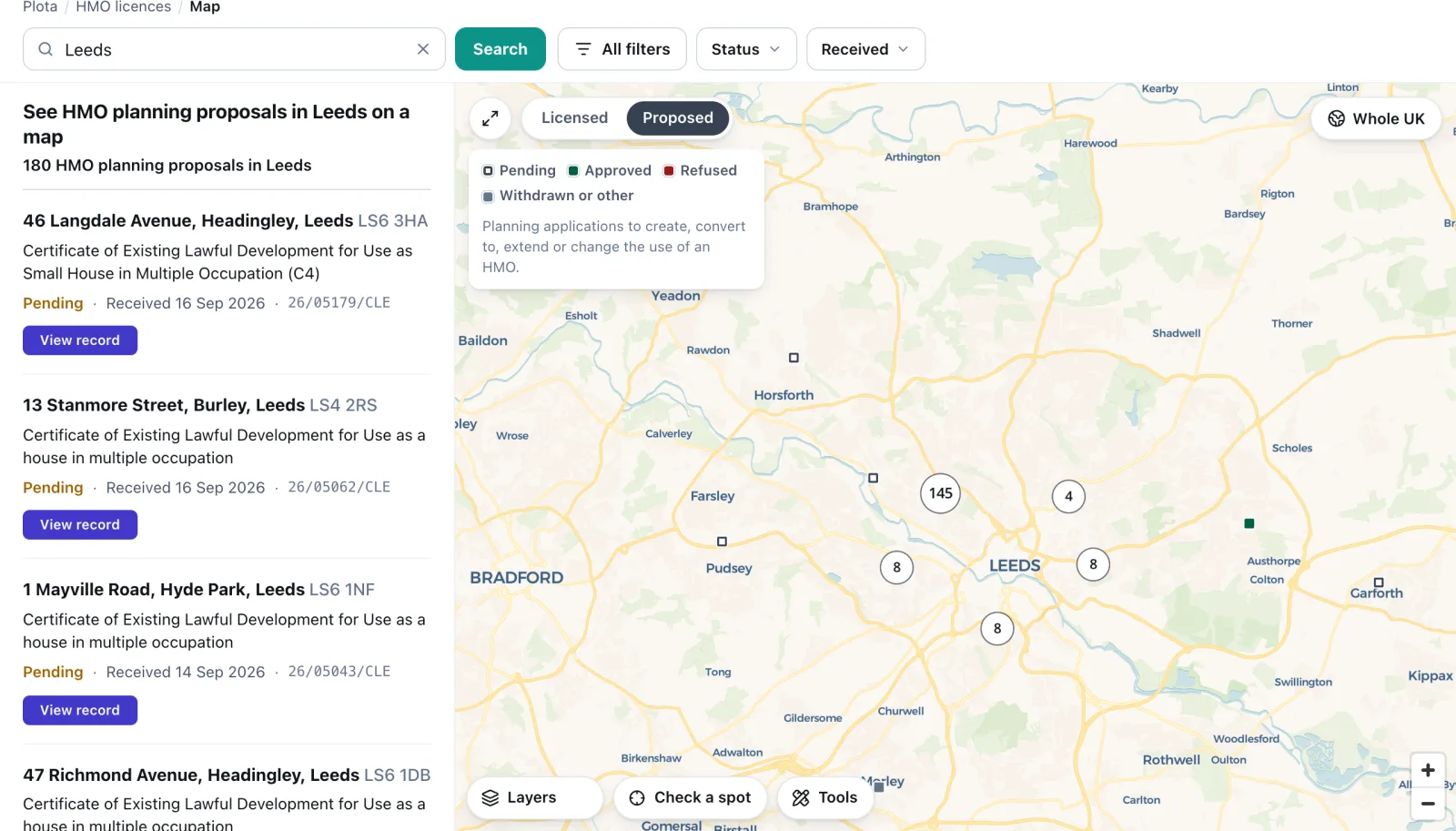
A switch above the map moves between Licensed and Proposed. Proposed shows planning applications to create, convert to, extend or change the use of an HMO, each marked pending, approved, refused or withdrawn. You can filter them by status and by the date the council received them. Condition discharges and amendments that only quote an earlier permission are left out.
Switching between the two compares where HMOs are licensed today with where new ones are being applied for.
In the API
GET /v1/hmo-licences returns the same licences as data. Each record adds the point's coordinates and how exact they are, and the dates we first and last read the licence on its council's register.
A call names a council, a postcode, a radius or a box and takes any of the map's filters, and a cursor pages through a whole register. No personal details are served.
One record from the response to this call:
GET /v1/hmo-licences?postcode=PO5&min_occupants=6

{ "address": "35, Hudson Road, Southsea", "postcode": "PO5 1HB",
  "uprn": 1775040948, "lat": 50.792364, "lng": -1.0846883,
  "geo_precision": "rooftop", "licence_type": "mandatory",
  "licence_expiry": "2031-09-06", "max_occupants": 7, "bedrooms": 7,
  "first_seen": "2026-09-25" }
A free API key is at the foot of the HMO licences page, with 500 requests to try it on your own patch and no card needed. Every field and filter is in the developer docs.
* Coverage is the share of HMO licences in the latest available official statistics held by the councils whose registers we show. The statistics count on different bases: England, the Ministry of Housing, Communities and Local Government's Local Authority Housing Statistics 2024-25, mandatory licences only; Wales, StatsWales, mandatory and additional licences; Scotland, the Scottish Government, licences in force; Northern Ireland, the Minister for Communities' answer to an Assembly question. Details come from each council's public register; some councils record details from the licence application, which may differ from the final licence.