20 Stowell Street, Newcastle Upon Tyne, NE1 4XQ Data via plota.co.uk
Proposal
Change of use of ground floor to restaurant and change of use of first floor to bar/nightclub (Sui Generis), alterations to shopfront and installation of extraction flue to rear elevation. Data via plota.co.uk
Application progress
Approved on 18 Dec 2025 · Delegated decision · Last checked 18 Oct 2026
Documents 17
Decision & officer reports 2
Statements & assessments 2
Plans & drawings 9
Application forms 2
Licences at this address
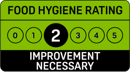
Licensed hours are what the licence permits, not opening times.
Site constraints 6
Show all 12 with distances
- 6 mTown Wall, With Morden, Heber and Ever TowersGrade I
- 71 mBlackfriars West RangeGrade I
- 86 mHouse of Recovery in Yard Behind College of Advanced TechnologyGrade II
- 91 mCo-Operative StoresGrade II
- 93 mBlackfriars East RangeGrade I
- 100 mBlackfriars South RangeGrade I
- 106 mTown Wall South of Numbers 74-80 Town Wall to Rear of Number 43Grade I
- 116 mUnnamed
- 135 mTown Wall With Durham TowerGrade I
- 136 m3, 4, 5, 6, 7, 8, Charlotte SquareGrade II
- 136 mNumber 1 and Railings Flanking StepsGrade II
- 145 mFormer Cooperative Wholesale Society Printing WorksGrade II
Checked on 6 October 2026. The pin for this application is the centre of its postcode rather than the building, so distances to nearby designations are measured from the postcode and can be out by the width of the postcode area. Historic England, the Environment Agency, Natural England, the Mining Remediation Authority and council datasets, Open Government Licence. A boundary can run through a site and the council holds the definitive record: confirm with the council before relying on this.
Every application in Newcastle upon Tyne - and every UK council - as a live feed, an API, or a bulk CSV export.
Nearby new applications
Waterstones, EMMERSON CHAMBERS Blackett Street, Newcastle Upon Tyne, NE1 7JF
Listed Building Application: Installation of external lighting to Blackett Stree...
Citygate Gallowgate, Newcastle Upon Tyne, NE1 4WH
Proposed installation of 1m high metal and timber clad planter boxes with integr...
Plot 1, Building B, The Helix, Saint James Boulevard, Newcastle Upon Tyne, NE4 5TF
Submission of details of Construction Method Statement to comply with condition ...
Platform 13, UNIT 1 TO 2 NEWCASTLE CENTRAL RAILWAY STATION Neville Street, Newcastle Upon Tyne, NE1 5DL
Submission of details of Ventilation System Installation to comply with conditio...
130 Grainger Street, Newcastle Upon Tyne, NE1 5AF
Display of 2no non-illuminated fascia signs.
Literary And Philosophical Society, 23 Westgate Road, Newcastle Upon Tyne, NE1 1SE
Listed Building Application Internal alterations to include installation of a pl...
Important details
- Council
- Newcastle upon Tyne
- Application type
- Detailed Application
- Postcode
- NE1 4XQ
- Received
- 11 Apr 2025
- Validated
- 9 Jul 2025
- Ward
- y_Monument (up to May 2026)
- Case officer
- Show
- Target decision
- 19 Dec 2025
- Decision
- Grant Conditionally
- Decision date
- 18 Dec 2025
- Decision level
- Delegated decision
- Applicant
- Show
- Agent
- Collaborative Design
How this decision compares
Decided in 162 days from validation, 96 days slower than Newcastle upon Tyne's median of 66 for changes of use. Approved, as 82% of changes of use here are.
Plota live figures for changes of use decided by Newcastle upon Tyne in the last twelve months, from validation. Newcastle upon Tyne decision record →
Consultation & key dates
- Statutory expiry
- 19 Dec 2025
Historical activity at this location
25 nearby applications on record - archival context, not part of the live application.
Nearby activity

Newcastle upon Tyne is slower than most councils at deciding householder applications, ranking #205 out of 296. Householder applications are slightly more likely to be approved here (95%) than the national average (90%).
Track this application
20 Stowell Street, Newcastle Upon Tyne, NE1 4XQ
Tracking this application
Not there in a minute? Check junk - especially Hotmail and Outlook.
Go to your dashboard →Sign in to view contact details
Applicant and case-officer names are hidden from public view for privacy. Create a free Plota account - or sign back in - and we'll show them, plus you get a dashboard for alerts and tracked applications.
