Before anyone buys a field or draws a scheme, somebody checks what is on the land. In the trade that is a desk study: open every register in turn, note what applies, write it up.
Every map on Plota now has a Check a spot button. Press it, drop a pin anywhere in England, Wales or Scotland, and we read 39 registers (from 81 published datasets) at that point and tell you what is there. Flood zones, listed buildings, conservation areas, scheduled monuments, green belt, national parks and landscapes, SSSIs, ancient woodland, Article 4 directions, tree preservation orders, farmland grades, rights of way and the rest.
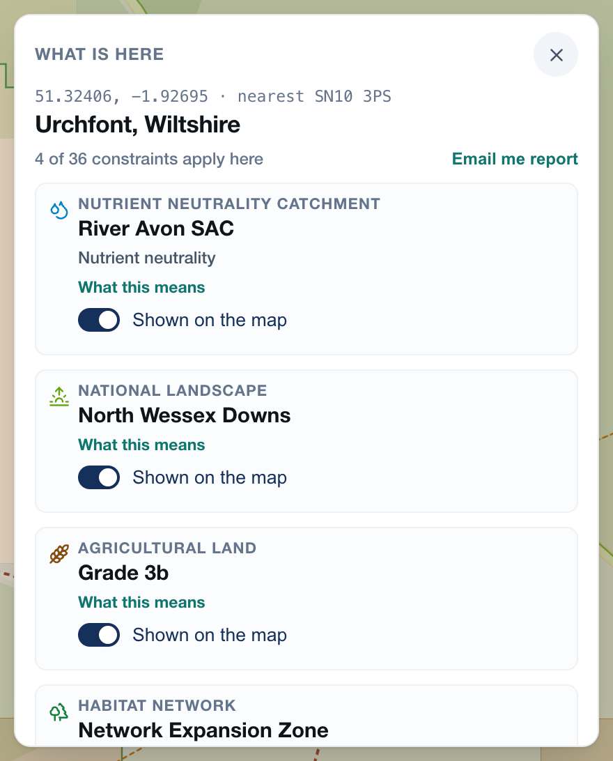
What the card shows
The card opens with a count: 4 of 36 constraints apply here. A register that could not be read is counted on its own and never folded into that total, because checked and clear has to mean checked.
The ones that matter most come first. A footpath crossing the site outranks a habitat network: obstructing a right of way without a diversion order is an offence, and the order has to be confirmed before work can start.
Under them are the registers that were read and came back clear. Knowing a site is outside the green belt and outside flood zones 2 and 3 is often the whole point of the exercise.
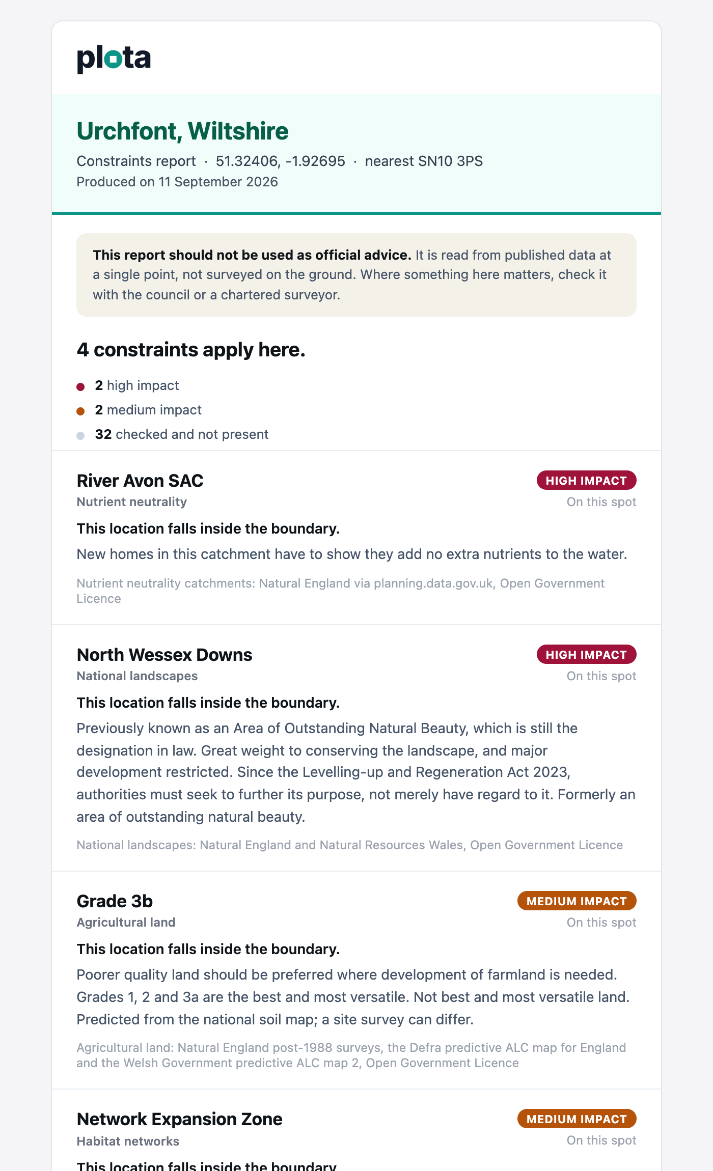
The emailed report
Press Email me report and the lot arrives in your inbox: the place, the coordinates, each finding and what it asks of a proposal, everything that was checked and clear, and a link that puts the pin back where you left it.
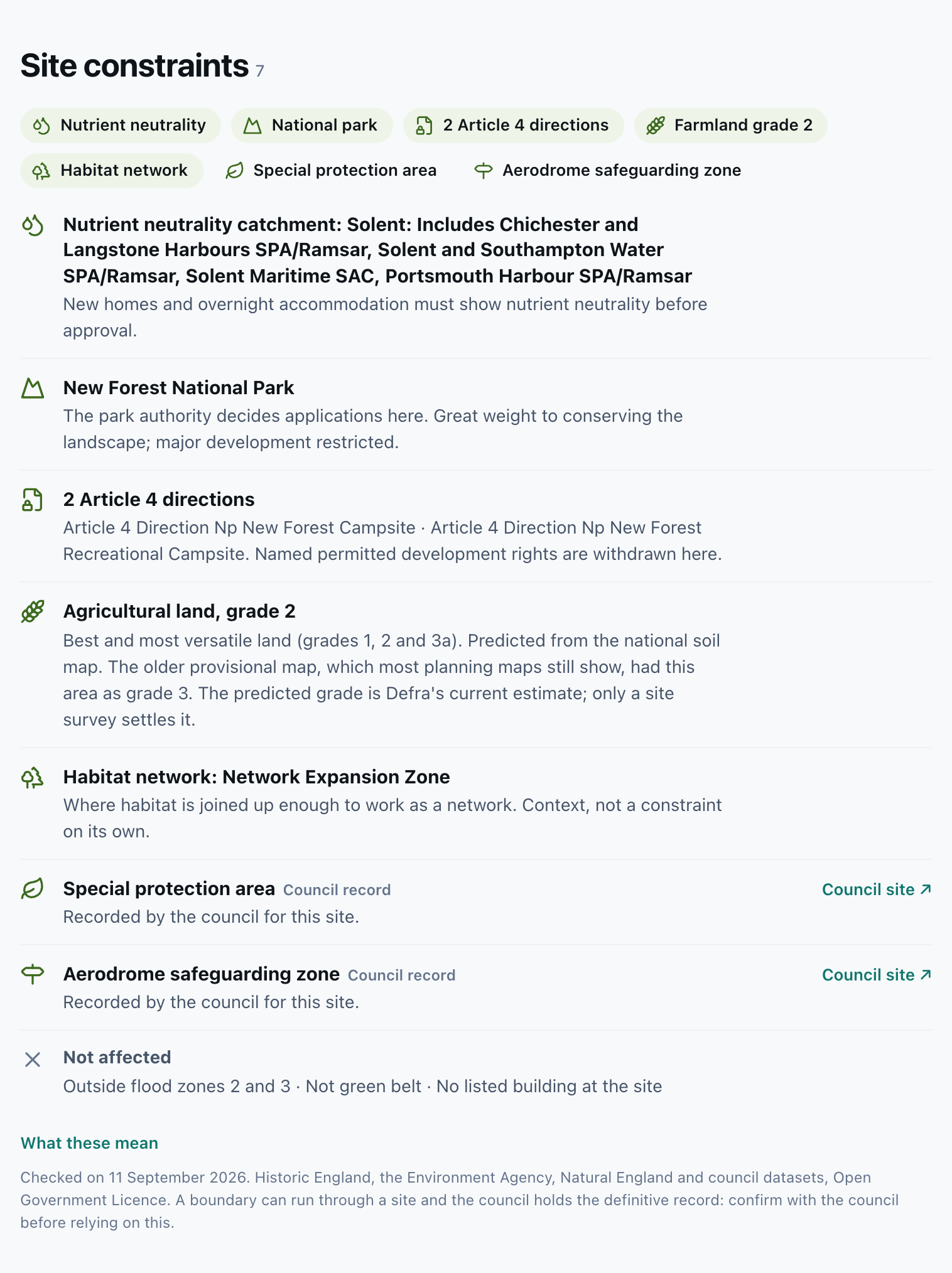
Shown on every application page
Applications get the same check without a pin. Every page with a location now carries a Site constraints section: the chips across the top, then a row for each one carrying the fact you would otherwise go and look up. Which listed building, and its list entry number. Which flood zone, and what it asks for. Whether the farmland is the best and most versatile land that policy protects. Where a council records something we cannot see in open data, an Article 4 direction it has never published as a boundary, the row says so and sends you to the council.