Norfolk House 8 Well Walk Cheltenham Gloucestershire GL50 3JX Data via plota.co.uk
Proposal
External logo signage at the ground floor of Norfolk House. Data via plota.co.uk
Application progress
Approved on 14 Sept 2026 · Delegated Decision · Last checked 17 Sept 2026
Documents 10
Decision & officer reports 2
Statements & assessments 1
Plans & drawings 4
Application forms 1
Consultation & comments 1
Other documents 1
Licence at this address
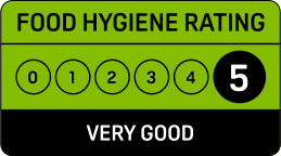
Licensed hours are what the licence permits, not opening times.
Site constraints 6
Show the other 55 with distances
- 4 m7, Well WalkGrade II
- 8 mNumbers 5 and 6 and Attached RailingsGrade II
- 9 mBank House (Number 45)Grade II
- 20 mThree Dragon and Onion Lamp Posts to South of Church of St MaryGrade II
- 28 mLibrary, Museum and Art Gallery and Attached RailingsGrade II
- 29 mCheltenham House and attached Theme and Variations sculptureGrade II
- 32 mTwo Dragon and Onion Lamp Posts to West of Church of St MaryGrade II
- 40 mTomb Chest and Headstone Approximately 1 Metre to South of South West Corner of Church of St MaryGrade II
- 42 m42, Clarence StreetGrade II
- 42 mCheltenham Minster (St Mary's)Grade I
- 42 m1, CRESCENT PLACE (See details for further address information)Grade II
- 50 mTomb Chest to Gardner Family Approximately 1 Metre East of South Porch of Church of St MaryGrade II
- 53 mNumber 2 and Attached RailingsGrade II
- 54 mChurch of St Matthew and boundary wall and gate piers to St George's Place and Clarence StreetGrade II*
- 55 mFormer Salem Baptist ChapelGrade II
- 59 mJohn Dower House and attached railingsGrade II
- 72 mChurchyard wall, piers and railings to east of Church of St MaryGrade II
- 75 m228, High StreetGrade II
- 75 mCrescent Parade and Attached RailingsGrade II
- 75 m22, 24 AND 26, CLARENCE STREET (See details for further address information)Grade II
- 80 mNumbers 1 to 6 and Attached Railings and Back of Premises of Echo OfficeGrade II
- 85 mHandel House (Number 51) and St Georges Vaults Public House (Number 53) and RailingsGrade II
- 86 mWorkshop/Warehouse Approximately 23 Metres South East of Church of St MaryGrade II
- 86 m19 and 21, Clarence StreetGrade II
- 88 mChurchyard Cross Approximately 4 Metres North of Chancel to Church of St MaryGrade II
- 89 mNumbers 1 to 4 and Attached RailingsGrade II
- 90 mNumbers 16 and 18 and Attached Area RailingsGrade II
- 90 mElectricity HouseGrade II
- 92 mTwo Pigs Public House and Attached Stable Range to SouthGrade II
- 92 m15 and 17, Clarence StreetGrade II
- 96 mNumbers 35 and 37 and Attached Area Railings to Number 37Grade II
- 97 mHeadstone Approximately 15 Metres North East of East End of Church of St MaryGrade II
- 98 m21 TO 31, PROMENADE (See details for further address information)Grade II
- 98 mNumbers 1 to 18 and Attached Area RailingsGrade II*
- 100 mNumbers 210 to 216 and Attached Railings Gate Piers and Overthrows to Two Churchyard Entrances toGrade II
- 101 m1-11, Clarence StreetGrade II
- 101 mClarence LampGrade II
- 104 mPromenade House (Echo Office)Grade II
- 107 m33, ST GEORGES PLACE (See details for further address information)Grade II
- 107 mNumbers 33 to 45 and Attached RailingsGrade II
- 109 mNumber 31 and Attached RailingsGrade II
- 113 mNumbers 15 and 17 and Attached Area RailingsGrade II
- 117 mNumber 27 and Attached RailingsGrade II
- 118 m11, St Georges PlaceGrade II
- 118 mMartin and CompanyGrade II
- 120 mNumbers 67 to 75 and Attached Railings to Numbers 67 to 73Grade II
- 131 m202 and 204, High StreetGrade II
- 133 mShaftesbury HallGrade II
- 135 mGroup of Six K6 Telephone Boxes Outside Number 23Grade II
- 136 mWalls, Railings, Gates and Piers to Manchester HouseGrade II
- 138 mManchester HouseGrade II
- 138 m200, High StreetGrade II
- 144 mThe Manchester HotelGrade II
- 146 mNumbers 47 to 83 and Attached Railings With Low Walls and End Piers to Numbers 71 and 73Grade II*
- 147 mChapel HouseGrade II
Checked on 6 October 2026. Historic England, the Environment Agency, Natural England, the British Geological Survey and UK Health Security Agency (radon, contains BGS materials © UKRI) and council datasets, Open Government Licence. A boundary can run through a site and the council holds the definitive record: confirm with the council before relying on this.
Building
From the energy performance certificate lodged in June 2016, the latest held for this property. The building may have changed since. View the certificate
Every application in Cheltenham - and every UK council - as a live feed, an API, or a bulk CSV export.
Nearby new applications
61 St Georges Road Cheltenham Gloucestershire GL50 3DU
Trees along rear passageway on top of river bank - trees overhanging rear garden...
Ashfield House Bayshill Lane Bayshill Road Cheltenham Gloucestershire
Cherry tree to the right of the gated entrance:- reduce all over back to previou...
Friends Meeting House Warwick Place Cheltenham Gloucestershire
Proposed installation of three air-to-air heat pumps following the removal of th...
320 Swindon Road Cheltenham Gloucestershire GL51 9JT
Non-material amendment of granted permission 24/00642/CONDIT to allow for landsc...
Hadley House Bayshill Road Cheltenham Gloucestershire GL50 3AW
Discharge of Condition 3 of listed building consent 26/00355/LBC and Condition 5...
Taco Bell 211 High Street Cheltenham Gloucestershire GL50 3HH
New fascia sign, projecting sign and window manifestations
Important details
- Council
- Cheltenham
- Application type
- Advertisement
- Postcode
- GL50 3JX
- Received
- 12 Feb 2026
- Validated
- 25 Mar 2026
- Ward
- Lansdown
- Case officer
- Show
- Target decision
- 3 Jun 2026
- Decision
- Grant
- Decision date
- 14 Sept 2026
- Decision level
- Delegated Decision
- Applicant
- Show
How this decision compares
Decided in 173 days from validation, 119 days slower than Cheltenham's median of 54 for signs and adverts. Approved, as 96% of signs and adverts here are.
Plota live figures for signs and adverts decided by Cheltenham in the last twelve months, from validation. Cheltenham decision record →
Public comments
No public comments yet.
10 neighbours consulted · Last counted 17 Sept 2026
Consultation & key dates
- Alt. reference
- PP-14688020
- Planning Portal ref
- PP-14688020
- Neighbours
- 30 Mar 2026
- Consultation
- 30 Mar 2026
- Comments by
- 30 Apr 2026
- Site or press notice
- 9 Apr 2026
- Statutory expiry
- 20 May 2026
- Env. assessment
- No
Historical activity at this location
27 previous applications on record - archival context, not part of the live application.
Previous applications at this address
Nearby activity

Cheltenham is faster than most councils at deciding householder applications, ranking #63 out of 296. Only 28% of applications have the time limit extended, well below the 41% national average - the council usually decides on time. Householder applications are more likely to be approved here than most councils, with a 98% approval rate vs 90% nationally.
Freehold boundary: © Crown copyright and database rights 2026, HM Land Registry. Polygons © Crown copyright and database rights 2026 Ordnance Survey 100026316. Conditions of use
Energy performance: Energy performance certificates from the Energy Performance of Buildings Register, Ministry of Housing, Communities and Local Government. Contains public sector information licensed under the Open Government Licence v3.0. © Crown copyright 2026.
Track this application
Norfolk House 8 Well Walk Cheltenham Gloucestershire GL50 3JX
Tracking this application
Not there in a minute? Check junk - especially Hotmail and Outlook.
Go to your dashboard →Sign in to view contact details
Applicant and case-officer names are hidden from public view for privacy. Create a free Plota account - or sign back in - and we'll show them, plus you get a dashboard for alerts and tracked applications.
