Royal Festival Hall South Bank London SE1 8XX Data via plota.co.uk
Proposal
Approval of details pursuant to condition 4 (Construction Method Statement) of planning permission 25/04001/FUL (Demolition/replacement of existing extension, and reconfiguration of unit 8 including change of use of storage area to Use Class E, together with enclosing the remaining space beneath the railway arches with slimline metal framed glazed screen with pivot doors, new slatted timber and metal facade to service wall, the replacement of doors to the side of the elevation with glazed bi-folding doors , and the relocation of the entrance doors, plus the creation of an outdoor seating area with associated public realm works) granted on 23.03.2026. Data via plota.co.uk
Application progress
Approved on 3 Jul 2026 · Delegated Decision · Last checked 8 Sept 2026
Documents 5
Decision & officer reports 1
Plans & drawings 1
Application forms 1
Associated applications 2
Part of
Conditions 4 discharged
- ConditionsApproval of details pursuant to condition 4 (Construction Method Statement)…This application26/01372/DET
Licences at this address
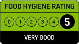
Licensed hours are what the licence permits, not opening times.
Site constraints 12
Show the other 5 with distances
- 5 mRoyal Festival HallGrade I
- 37 mBust of Nelson Mandela, Royal Festival Hall, LondonGrade II
- 60 mThe Queen Elizabeth Hall, Purcell Room and Hayward Gallery and associated terraced walkways and stairsGrade II
- 90 mZemran sculptureGrade II
- 123 mWaterloo BridgeGrade II*
Checked on 6 October 2026. Historic England, the Environment Agency, Natural England, the Planning Inspectorate, Transport for London (public transport access levels, Powered by TfL Open Data, OGL v3.0, contains OS data © Crown copyright and database right 2025) and council datasets, Open Government Licence. A boundary can run through a site and the council holds the definitive record: confirm with the council before relying on this.
Every application in Lambeth - and every UK council - as a live feed, an API, or a bulk CSV export.
Other new applications on this street
The Southbank Centre Belvedere Road London SE1 8XX
Approval of details pursuant to condition 18 (schedule of the proposed structure...
Royal Festival Hall, Unit 8 South Bank London Lambeth SE1 8XX
Installation of signage relating to Unit 8 at the Southbank Centre.
Nearby new applications
14 Aquinas Street London SE1 8AE
Replacement of existing non original rear doors to garden with timber framed doo...
Franklin Wilkins Building 150 Stamford Street London SE1 9NH
Installation of 5x display panels
17 Embankment Place London WC2N 6NN
Display of non illuminated Aluminium digital display measuring 0.64m X 1.18m, no...
1 - 3 Whittlesey Street London SE1 8SZ
Proposed single-storey ground floor rear extension with bi-fold doors and double...
Victoria Embankment Gardens Villiers Street London WC2N 6ND
Installation of a single non illuminated public interpretation panel measuring 3...
Flat 5 19 Buckingham Street London WC2N 6EG
Replacement of an air conditioning unit to lightwell wall at fourth floor level ...
Important details
Public comments
No public comments yet.
Last counted 8 Sept 2026
Consultation & key dates
- Comments by
- 4 Jun 2026
- Statutory expiry
- 25 Jun 2026
- Env. assessment
- No
Historical activity at this location
48 previous applications on record - archival context, not part of the live application.
Previous applications at this address
Nearby activity

Lambeth ranks #164 out of 296 councils for householder decision speed. 47% of applications have the time limit extended, above the 41% national average. Lambeth is also one of the strictest councils - it refuses more householder applications than almost any other, with only 81% approved vs 90% nationally.
Track this application
Royal Festival Hall South Bank London SE1 8XX
Tracking this application
Not there in a minute? Check junk - especially Hotmail and Outlook.
Go to your dashboard →Sign in to view contact details
Applicant and case-officer names are hidden from public view for privacy. Create a free Plota account - or sign back in - and we'll show them, plus you get a dashboard for alerts and tracked applications.

Check your email
Council archive
Royal Festival Hall South Bank London SE1 8XX
Demolition/replacement of existing extension, and reconfiguration of unit 8 including change of use of storage area to Use Class E, together with enclosing the remaining space beneath the railway arches with slimline metal framed glazed screen with pivot doors, new slatted timber and metal facade to service wall, the replacement of doors to the side of the elevation with glazed bi-folding doors , and the relocation of the entrance doors, plus the creation of an outdoor seating area with associated public realm…
- Received
- 23 Dec 2025
- Decided
- 23 Mar 2026
- Outcome
- Approved