The Admirals Arm Trafalgar Court West Street Queenborough Kent ME11 5AD Data via plota.co.uk

26/502379/FULL - Full Withdrawn

Proposal

Section 73 - Application for varitation of condition 5 (there shall be no amplified music played at the application site) to allow music indoors pursuant to for - Change of use from light industrial (office/storage) B1/B8 to Micropub A4. Data via plota.co.uk

View original council record ↗Last checked

Application progress

✓
Received
23 Jun 2026
✓
Consultation
21 Jul 2026
−
Withdrawn
3 Sept 2026

Withdrawn on 3 Sept 2026 · Delegated Decision · Last checked 3 Sept 2026

Documents 76

Consultation & comments 72

PDF Environmental Health Comment Consultee Comment · 12 Aug 2026 View ↗ PDF Online Comment Neighbour Comments · 9 Aug 2026 View ↗ PDF Online Comment Neighbour Comments · 9 Aug 2026 View ↗ PDF Online Comment Neighbour Comments · 9 Aug 2026 View ↗ PDF Online Comment Neighbour Comments · 9 Aug 2026 View ↗ PDF Online Comment Neighbour Comments · 9 Aug 2026 View ↗ PDF Online Comment Neighbour Comments · 7 Aug 2026 View ↗ PDF Online Comment Neighbour Comments · 6 Aug 2026 View ↗ PDF Neighbour Comments Neighbour Comments · 5 Aug 2026 View ↗ PDF Online Comment Neighbour Comments · 3 Aug 2026 View ↗ PDF Online Comment Neighbour Comments · 31 Jul 2026 View ↗ PDF . Queenborough Town Council Queenborough Town Council Consultee Comment · 30 Jul 2026 View ↗ PDF Online Comment Neighbour Comments · 29 Jul 2026 View ↗ PDF Neighbour Comments Neighbour Comments · 28 Jul 2026 View ↗ PDF Online Comment Neighbour Comments · 24 Jul 2026 View ↗
PDF Commenter’s name hidden Show Neighbour Comments · 24 Jul 2026 View ↗
PDF KCC Highways Consultee Comment · 22 Jul 2026 View ↗ PDF Online Comment Neighbour Comments · 21 Jul 2026 View ↗ PDF Neighbour Comments Neighbour Comments · 21 Jul 2026 View ↗ PDF Online Comment Neighbour Comments · 20 Jul 2026 View ↗ PDF Neighbour Comments Neighbour Comments · 20 Jul 2026 View ↗ PDF Online Comment Neighbour Comments · 17 Jul 2026 View ↗ PDF Online Comment Neighbour Comments · 16 Jul 2026 View ↗ PDF Online Comment Neighbour Comments · 14 Jul 2026 View ↗ PDF Online Comment Neighbour Comments · 14 Jul 2026 View ↗ PDF Online Comment Neighbour Comments · 14 Jul 2026 View ↗ PDF Online Comment Neighbour Comments · 14 Jul 2026 View ↗ PDF Online Comment Neighbour Comments · 14 Jul 2026 View ↗ PDF Online Comment Neighbour Comments · 13 Jul 2026 View ↗ PDF Online Comment Neighbour Comments · 13 Jul 2026 View ↗ PDF Online Comment Neighbour Comments · 13 Jul 2026 View ↗ PDF Online Comment Neighbour Comments · 13 Jul 2026 View ↗ PDF Online Comment Neighbour Comments · 13 Jul 2026 View ↗ PDF KCC Highways Consultee Comment · 13 Jul 2026 View ↗ PDF Online Comment Neighbour Comments · 13 Jul 2026 View ↗ PDF Online Comment Neighbour Comments · 13 Jul 2026 View ↗ PDF Online Comment Neighbour Comments · 13 Jul 2026 View ↗ PDF Online Comment Neighbour Comments · 12 Jul 2026 View ↗ PDF Online Comment Neighbour Comments · 12 Jul 2026 View ↗ PDF Online Comment Neighbour Comments · 12 Jul 2026 View ↗ PDF Online Comment Neighbour Comments · 12 Jul 2026 View ↗ PDF Online Comment Neighbour Comments · 12 Jul 2026 View ↗ PDF Online Comment Neighbour Comments · 12 Jul 2026 View ↗ PDF Online Comment Neighbour Comments · 12 Jul 2026 View ↗ PDF Online Comment Neighbour Comments · 11 Jul 2026 View ↗ PDF Online Comment Neighbour Comments · 11 Jul 2026 View ↗ PDF Online Comment Neighbour Comments · 11 Jul 2026 View ↗ PDF Online Comment Neighbour Comments · 11 Jul 2026 View ↗ PDF Online Comment Neighbour Comments · 11 Jul 2026 View ↗ PDF Online Comment Neighbour Comments · 11 Jul 2026 View ↗ PDF Online Comment Neighbour Comments · 11 Jul 2026 View ↗ PDF Online Comment Neighbour Comments · 11 Jul 2026 View ↗ PDF Online Comment Neighbour Comments · 11 Jul 2026 View ↗ PDF Online Comment Neighbour Comments · 10 Jul 2026 View ↗ PDF Online Comment Neighbour Comments · 10 Jul 2026 View ↗ PDF Online Comment Neighbour Comments · 10 Jul 2026 View ↗ PDF Online Comment Neighbour Comments · 10 Jul 2026 View ↗ PDF Online Comment Neighbour Comments · 10 Jul 2026 View ↗ PDF Online Comment Neighbour Comments · 10 Jul 2026 View ↗ PDF Online Comment Neighbour Comments · 10 Jul 2026 View ↗ PDF Online Comment Neighbour Comments · 10 Jul 2026 View ↗ PDF Online Comment Neighbour Comments · 10 Jul 2026 View ↗ PDF Online Comment Neighbour Comments · 10 Jul 2026 View ↗ PDF Online Comment Neighbour Comments · 10 Jul 2026 View ↗ PDF Online Comment Neighbour Comments · 10 Jul 2026 View ↗ PDF Online Comment Neighbour Comments · 10 Jul 2026 View ↗ PDF Online Comment Neighbour Comments · 10 Jul 2026 View ↗ PDF Online Comment Neighbour Comments · 10 Jul 2026 View ↗ PDF Online Comment Neighbour Comments · 10 Jul 2026 View ↗ PDF Online Comment Neighbour Comments · 10 Jul 2026 View ↗ PDF Online Comment Neighbour Comments · 10 Jul 2026 View ↗ PDF Neighbour Comment Neighbour Comments · 10 Jul 2026 View ↗

All documents on the council site ↗

Associated applications 2

  • Part of

    FullApprovedcouncil archive

    Conditions 5 variation sought

    • VariationSection 73 - Application for varitation of condition 5 (there shall be no amplified music…WithdrawnThis application26/502379/FULL

Licence at this address
  • Licence The Admirals Arm Premises licence · in force since 26 Jan 2026 · elsewhere in the building Licensed hours: alcohol until 23:00
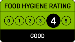
    Food hygiene rating: 4 (Good)Inspected 30 Mar 2026

Licensed hours are what the licence permits, not opening times.

Site constraints 10

Flood zone 3, rivers and sea
High chance: a 1 in 100 or greater annual chance from rivers, or 1 in 200 from the sea. Any development here needs a flood risk assessment. Defences are not counted.
The Environment Agency flood map for planning. Homes in zone 3 must also pass the sequential test. Surface water flooding is a separate map.
Flood map ↗
Leysdown Beach (clockwise) to Oak Lane, Minster across the site
Matters where it crosses or adjoins the site; the route and its margin are protected.
Queenborough conservation area
Demolition needs planning permission and permitted development is restricted.
The council must give weight to preserving or enhancing the area's character and appearance. Not every council has published its boundaries as open data.
Council document ↗
Public footpath 10 m away
Matters where it crosses or adjoins the site: obstructing a path without a diversion order is an offence, and work cannot start until the order is confirmed.
Compiled from highway authority data, not the legal definitive map. A few authorities have not published, so no path shown is not proof there is none.
Ramsar wetland 55 m away: Medway Estuary & Marshes
Work nearby can need a habitats assessment.
Harm to a protected site is only accepted where there is no alternative and an overriding public interest.
SSSI 55 m away: Tower Hill to Cockham Wood SSSI
Natural England may need consulting, depending on what is proposed.
Sites of special scientific interest are the best wildlife and geological sites in the country. Development likely to harm one is rarely permitted.
9 listed buildings within 150 m
Nearest: Swale House, Grade II, 25 m away · 9 Grade II
The site itself is not listed. Listed building consent is needed for work that affects the special interest of a listed building, inside or out, on top of planning permission. Setting can be a consideration for buildings nearby; there is no fixed radius.
Show all 9 with distances
Historic England ↗
Habitat network: Network Enhancement Zone 2
Where habitat is joined up enough to work as a network. Context, not a constraint on its own.
Also on the record
Nature improvement area: Greater Thames Marshes; Inside the Queenborough built-up area.
Not affected
Not green belt · No scheduled monument at the site

Checked on 6 October 2026. Historic England, the Environment Agency, Natural England and council datasets, Open Government Licence. A boundary can run through a site and the council holds the definitive record: confirm with the council before relying on this.

Work with planning data?

Every application in Swale - and every UK council - as a live feed, an API, or a bulk CSV export.

About Plota's data service

Important details

Council
Swale
Application type
Full
Postcode
ME11 5AD
Received
23 Jun 2026
Validated
23 Jun 2026
Ward
Queenborough And Halfway
Parish
Queenborough
Case officer
Show
Target decision
18 Aug 2026
Decision
Application Withdrawn
Decision date
3 Sept 2026
Decision level
Delegated Decision
Applicant
Show

Consultation & key dates

Alt. reference
PP-15023996
Planning Portal ref
PP-15023996
Comments by
11 Aug 2026
Site or press notice
21 Jul 2026
Statutory expiry
18 Aug 2026
Env. assessment
No
Swale
Planning Authority Score
2.3/10
Poor
#263 of 296 councils
Relevant to this application:
Change of use

Swale is one of the slowest councils in England for householder decisions, ranking #275 out of 296. The council extends the time limit on 70% of applications - one of the highest rates in England. Expect your application to take longer than the standard deadline. Householder applications are slightly more likely to be approved here (94%) than the national average (90%).

Among the slowest councils in England
for householder decisions
These figures are council-wide context, not a prediction for this application. View full council performance
Swale decision statistics
Based on MHCLG data, the year to March 2026
89%
Overall approval rate
Above avg (87%) #143 of 296
94%
Householder approved
Above avg (90%) #120 of 296
37%
Decided in 8 weeks
Below avg (63%) #275 of 296
70%
Extended time limit
Above avg (41%) #286 of 296
72%
Minor dwellings approved
81 decided (1-9 homes)
84%
Major dwellings approved
25 decided (10+ homes)
95%
Change of use approved
22 decided
658
Total decisions
71 refused in the year to March 2026

Freehold boundary: © Crown copyright and database rights 2026, HM Land Registry. Polygons © Crown copyright and database rights 2026 Ordnance Survey 100026316. Conditions of use