O'Neills Albert Road Southsea PO5 2SX Data via plota.co.uk
Proposal
Refurbishment of 3no. existing internally illuminated O'Neill's signs; replacement head to existing pole sign, signwritten mural to replace existing and cartoon style burglar by 1st floor windows. Data via plota.co.uk
Application progress
Under consideration
No decision has been issued yet. Plota predicted a decision around 29 Oct 2026; it is now day 62.
Licence at this address
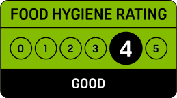
Licensed hours are what the licence permits, not opening times.
Site constraints 4
Checked on 6 October 2026. Historic England, the Environment Agency, Natural England and council datasets, Open Government Licence. A boundary can run through a site and the council holds the definitive record: confirm with the council before relying on this.
Every application in Portsmouth - and every UK council - as a live feed, an API, or a bulk CSV export.
Other new applications on this street
Kings Theatre Albert Road Southsea PO5 2QJ
Application to discharge condition 5 (Approved Plans) of planning permission 25/...
37 Albert Road Southsea PO5 2SE
Change of use of ground floor from commercial/retail (Class E) to hot food takea...
Buffalo Takeaway 2B Albert Road Portsmouth PO5 2SH
Application to vary condition 2 (operating hours) of planning permission 11/0093...
Keyes Court Albert Road Southsea PO5 2SS
Application for Certificate of Lawful Development for proposed alterations to im...
Nearby new applications
Site Of Former St Johns College Grove Road South Southsea PO5 3QW
Application to part discharge condition 5 (CEMP - Phase 3) of planning permissio...
22 Belmont Street Southsea PO5 1ND
Change of use from house in multiple occupation (Class C4) to purposes falling w...
2 - 4 Palmerston Road Southsea PO5 3QH
Shopfront alterations to accommodate the subdivision of retail units
12 Victoria Road South Southsea PO5 2BZ
Change of use from 11 person/11 bedroom house in multiple occupation, to 9 perso...
60D Victoria Road South Southsea PO5 2BT
Application for Certificate of Lawful Development for existing use as house in m...
Barrington Cottage 51B Kent Road Southsea PO5 3EL
Removal and replacement of rear conservatory
Important details
- Council
- Portsmouth
- Application type
- Advert Application
- Postcode
- PO5 2SX
- Received
- 27 Aug 2026
- Validated
- 28 Aug 2026
- Ward
- St Jude
- Case officer
- Show
- Target decision
- 23 Oct 2026
- Decision level
- Delegated
- Applicant
- Show
- Agent
- Morgan Signs & Design Limited
Decision outlook
Day 62, past the statutory target. 84% of signs and adverts in Portsmouth are decided within thirteen weeks, which runs to 27 Nov 2026; extensions of time are common, and the council need not decide on the day. Last seen undecided on 27 Oct 2026.
Plota live figures for signs and adverts decided by Portsmouth in the last twelve months, from validation. Portsmouth decision record →
Public comments
32 neighbours consulted · Last counted 27 Oct 2026
Consultation & key dates
- Alt. reference
- PP-15190290
- Planning Portal ref
- PP-15190290
- Neighbours
- 11 Sept 2026
- Consultation
- 11 Sept 2026
- Comments by
- 9 Oct 2026
- Statutory expiry
- 23 Oct 2026
- Env. assessment
- No
Historical activity at this location
25 nearby applications on record - archival context, not part of the live application.
Nearby activity

Portsmouth ranks #188 out of 296 councils for householder decision speed. 48% of applications have the time limit extended, above the 41% national average. Householder applications are slightly less likely to be approved here (89%) than the national average (90%).
Freehold boundary: © Crown copyright and database rights 2026, HM Land Registry. Polygons © Crown copyright and database rights 2026 Ordnance Survey 100026316. Conditions of use
Track this application
O'Neills Albert Road Southsea PO5 2SX
Tracking this application
Not there after a minute? Check your junk folder. It's from alerts@plota.co.uk.
Go to your dashboard →Sign in to view contact details
Applicant and case-officer names are hidden from public view for privacy. Create a free Plota account - or sign back in - and we'll show them, plus you get a dashboard for alerts and tracked applications.

The consultation period closed on 9 Oct 2026.